Hoge der A
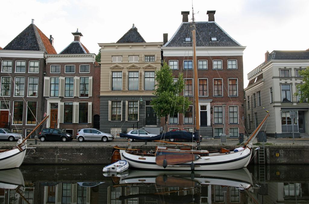
Between the Hoge der A and Low of the A, the A. Through this stream ships came in to load and unload. You will find 28 national monuments here.
The stream the A flows between the Hoge der A and Lage of the A. The quay of the Hoge der A is much higher than that of the Lage der A. It is said that the high quay was used for loading and unloading ships at high tide, the low at low tide. The influence of the sea was noticeable in Groningen until 1877, which ended after the damming of the Reitdiep. Around this beautiful part of Groningen you will find many national monuments, including many old warehouses.
6.559586
Free city guide
Groningen

Discover this spot
Share this spot
Discover Groningen with a ready-made guide

Free city guide
Groningen
Follow this guide through 10 artistic places
Free city guide
Groningen
Get to know the culinary side of this city with taste
Free city guide
Groningen
In the Folkingestraat you will find a unique mix of shops
Free city guide
Groningen
From soup shop to bakery café, here you are good for lunch
Free city guide
Groningen
Your first spot is added to your city guide!
Only the best
Together with locals we've collected all the places that you shouldn't miss. Instantly find unique, sometimes hidden hotspots or make plans for a complete city trip.

Create your perfect city guide
Pick your favorite places in a few minutes and start exploring with your own city guide. Or instantly start your adventure with a ready-made guide.
Share and inspire
Inspire others by sharing your best tips and photos. Be part of our community of locals and explorers and help everyone experience an unforgettable city trip.